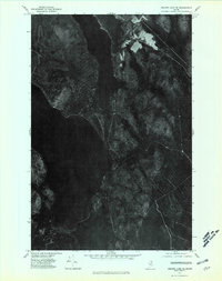
1975 Map of Square Lake SE
USGS Topo · Published 1981About this map
Square Lake and its deep northern waters dominate this orthophotograph, providing a rare aerial perspective of the Aroostook County wilderness in the mid-1970s. This imagery-based map replaces traditional topographic linework with a direct visual of the forested landscape, revealing the sharp contrast between the dense woodlands and the clearings of agricultural fields. Along the eastern shore of Cross Lake, several small farmsteads and access roads are visible, suggesting the enduring presence of rural homesteads in this isolated region. The narrow channel between the lakes and the sequestered waters of Carry Pond highlight the complex hydrological connections of the Fish River chain of lakes. This document is a critical resource for understanding the land-use patterns and forest density before modern logging and development further altered the Maine North Woods.
Find a feature on this map
3 named features on this map. Tap any name to fly to it.
Don’t see what you’re looking for? This feature index may not catch every label — zoom into the map to look around manually.
Map Details
Editions of this 1975 Square Lake SE Map
This is the sole edition of this map. No revisions or reprints were ever made.
Other maps of this area

1927 · Stockholm
USGS Topo · 1:48,000

1927 · Square Lake
USGS Topo · 1:48,000

1929 · Portage
USGS Topo · 1:62,500

1929 · Caribou
USGS Topo · 1:48,000

1931 · Square Lake
USGS Topo · 1:62,500

1931 · Portage
USGS Topo · 1:62,500

1931 · Stockholm
USGS Topo · 1:62,500

1932 · Caribou
USGS Topo · 1:62,500

1953 · Stockholm
USGS Topo · 1:62,500

1953 · Square Lake
USGS Topo · 1:62,500
Featured Places
- Square Lake, ME
- Westmanland, ME
- Burnt Landing, Square Lake
- Cross Lake Township, ME
- Sinclair Township, ME