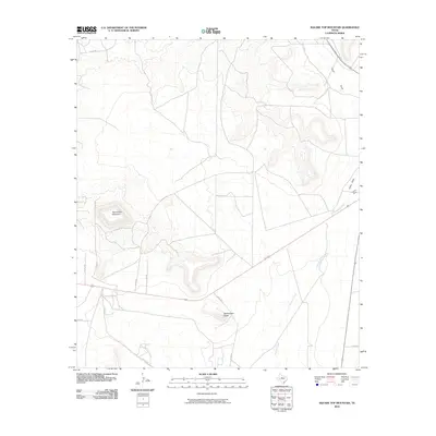
2010 Map of Square Top Mountain
USGS Topo · Published 2010About this map
Square Top Mountain and Rattlesnake Butte anchor this corner of Upton County, where the high plains begin to break into more complex drainages. The landscape is defined by the intermittent watercourses of China Draw and Fivemile Creek, which cut through the arid terrain. This mapping effort captures a network of rural county roads, including Co Rd 450 and Co Rd 485, that connect isolated ranching properties and wind through the varying elevations.
Find a feature on this map
14 named features on this map. Tap any name to fly to it.
Don’t see what you’re looking for? This feature index may not catch every label — zoom into the map to look around manually.
Map Details
Editions of this 2010 Square Top Mountain Map
This is the sole edition of this map. No revisions or reprints were ever made.
Other maps of this area

1928 · Crane
USGS Topo · 1:125,000

1928 · Rankin
USGS Topo · 1:125,000

1954 · Pecos
USGS Topo · 1:250,000

1954 · San Angelo
USGS Topo · 1:250,000

1957 · Pecos
USGS Topo · 1:250,000

1958 · San Angelo
USGS Topo · 1:250,000

1965 · San Angelo
USGS Topo · 1:250,000
1970 · Cedar Canyon
USGS Topo · 1:24,000

1970 · Sevenmile Corner
USGS Topo · 1:24,000
1970 · Rankin
USGS Topo · 1:24,000