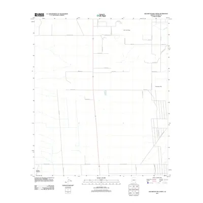
2011 Map of Squaretop Hills West
USGS Topo · Published 2011About this map
Grizzles Orchard and the high desert terrain of Cochise County are documented in this 2011 topographic survey. The landscape is characterized by a network of ranching roads and trails that traverse the arid flats between prominent landforms like the Squaretop Hills and Ash Creek Ridge. This era shows a structured grid of rural property boundaries and access ways, such as Brand Ranch Rd and S Morgan Ranch Rd, which reflect the region's long-standing ranching heritage. The northern portion of the map is defined by the drainage of Ash Creek, while the southern reaches are connected by E Rucker Canyon Rd and W Courtland Rd. These road names often preserve the identity of local families and historic destinations, including references to the route toward old S Fort Bowie Rd.
Find a feature on this map
32 named features on this map. Tap any name to fly to it.
Don’t see what you’re looking for? This feature index may not catch every label — zoom into the map to look around manually.
Map Details
Editions of this 2011 Squaretop Hills West Map
This is the sole edition of this map. No revisions or reprints were ever made.
Other maps of this area

1916 · Pearce
USGS Topo · 1:125,000

1922 · Swisshelm
USGS Topo · 1:62,500

1925 · Gleeson
USGS Topo · 1:62,500

1926 · Light
USGS Topo · 1:62,500

1926 · Courtland
USGS Topo · 1:62,500

1955 · Douglas
USGS Topo · 1:250,000

1958 · Squaretop Hills
USGS Topo · 1:62,500

1958 · Swisshelm Mtn
USGS Topo · 1:62,500

1958 · Pearce
USGS Topo · 1:62,500
1958 · Gleeson
USGS Topo · 1:62,500