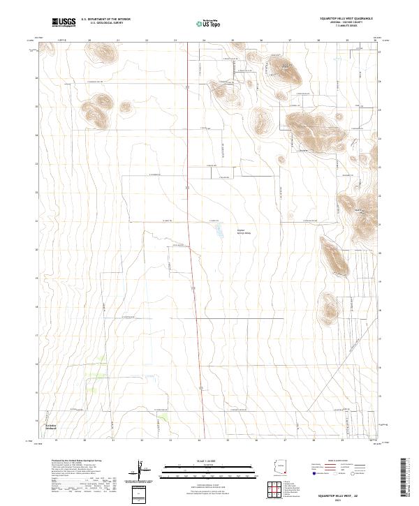
2021 Map of Squaretop Hills West
USGS Topo · Published 2021About this map
Sulphur Springs Valley dominates the central landscape of this Cochise County region, showing a transition between broad basin floors and the rising terrain of the Squaretop Hills. The map details a modern rural settlement pattern characterized by long ranch roads and residential avenues, such as Pueblo Bonito Ave and E Duke Ranch Rd. In the south, the presence of Grizzles Orchard points to agricultural activity at the edge of the valley floor. The northern section is defined by more prominent relief, including Ash Creek Ridge and the drainage of Ash Cr. This area is crisscrossed by specialized routes like Pt Pleasant Trl and E Rainbows End Trl, reflecting the contemporary subdivision and naming of the desert landscape east of the Dragoon Mountains.
Find a feature on this map
55 named features on this map. Tap any name to fly to it.
Don’t see what you’re looking for? This feature index may not catch every label — zoom into the map to look around manually.
Map Details
Editions of this 2021 Squaretop Hills West Map
This is the sole edition of this map. No revisions or reprints were ever made.
Other maps of this area

1916 · Pearce
USGS Topo · 1:125,000

1922 · Swisshelm
USGS Topo · 1:62,500

1925 · Gleeson
USGS Topo · 1:62,500

1926 · Light
USGS Topo · 1:62,500

1926 · Courtland
USGS Topo · 1:62,500

1955 · Douglas
USGS Topo · 1:250,000

1958 · Squaretop Hills
USGS Topo · 1:62,500

1958 · Swisshelm Mtn
USGS Topo · 1:62,500

1958 · Pearce
USGS Topo · 1:62,500
1958 · Gleeson
USGS Topo · 1:62,500