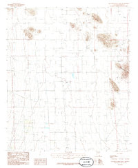
1986 Map of Squaretop Hills West
USGS Topo · Published 1986About this map
Squaretop Hills rise along the eastern edge of this landscape, creating a distinct topographic boundary for the basin below. The area is defined by a series of intermittent water courses and low ridges, notably Ash Creek Ridge and the winding path of Ash Creek to the north. These drainage patterns suggest a landscape shaped by seasonal water flow, typical of the high desert environment in Cochise County.
Find a feature on this map
9 named features on this map. Tap any name to fly to it.
Don’t see what you’re looking for? This feature index may not catch every label — zoom into the map to look around manually.
Map Details
Editions of this 1986 Squaretop Hills West Map
This is the sole edition of this map. No revisions or reprints were ever made.
Other maps of this area

1916 · Pearce
USGS Topo · 1:125,000

1922 · Swisshelm
USGS Topo · 1:62,500

1925 · Gleeson
USGS Topo · 1:62,500

1926 · Light
USGS Topo · 1:62,500

1926 · Courtland
USGS Topo · 1:62,500

1955 · Douglas
USGS Topo · 1:250,000

1958 · Squaretop Hills
USGS Topo · 1:62,500

1958 · Swisshelm Mtn
USGS Topo · 1:62,500

1958 · Pearce
USGS Topo · 1:62,500
1958 · Gleeson
USGS Topo · 1:62,500