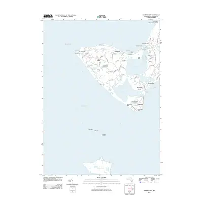
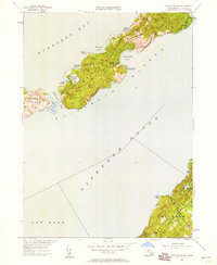
2012 Map of Squibnocket
USGS Topo · Published 2012About this map
The Gay Head Cliffs and the Wampanoag Indian Lands anchor this survey of the southwestern tip of Martha's Vineyard. This area, known as Gay Head, maintains a distinct cultural and maritime character through features like the Gay Head Indian Burying Ground and the historic Gay Head Light. The landscape is a network of coastal ponds including Menemsha Pond and Squibnocket Pond, separated from the Atlantic Ocean by narrow stretches like Long Beach. To the north, the fishing village of Menemsha centers around Dutcher Dock and the Menemsha Creek Entrance Jetty Light. Small settlements and seasonal destinations such as Lobsterville, Nashaquitsa, and Squibnocket are connected by a winding road network, including Moshup Trl and State Rd, while the uninhabited Nomans Land lies several miles offshore to the south.
Find a feature on this map
82 named features on this map. Tap any name to fly to it.
Don’t see what you’re looking for? This feature index may not catch every label — zoom into the map to look around manually.
Map Details
Editions of this 2012 Squibnocket Map
This is the sole edition of this map. No revisions or reprints were ever made.
Other maps of this area

1887 · Gay Head
USGS Topo · 1:62,500

1889 · Gay Head
USGS Topo · 1:62,500

1893 · Gay Head
USGS Topo · 1:62,500

1942 · Marthas Vineyard
USGS Topo · 1:125,000
1944 · Naushon Island
USGS Topo · 1:31,680
1944 · Squibnocket
USGS Topo · 1:31,680
1944 · Cuttyhunk
USGS Topo · 1:31,680

1947 · Providence
USGS Topo · 1:250,000

1948 · Providence
USGS Topo · 1:250,000
1949 · Naushon Island
USGS Topo · 1:24,000