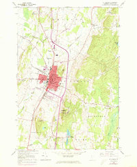
1964 Map of St. Albans
USGS Topo · Published 1973About this map
St Albans serves as a dense municipal and transportation hub in Franklin County, anchored by the extensive Central Vermont rail lines and the prominent Bellows Free Academy. The landscape is defined by its institutional and civic presence, featuring the Court House, City Hall, and the Immigration Bldg, alongside modern mid-century additions like the Brainerd Shopping Center. The outskirts of the city are marked by numerous family and community burial grounds, such as Kattle Cem and Warner Cem, reflecting the area's deep-rooted settlement history.
Find a feature on this map
57 named features on this map. Tap any name to fly to it.
Don’t see what you’re looking for? This feature index may not catch every label — zoom into the map to look around manually.
Map Details
Editions of this 1964 St. Albans Map
3 editions found
Other maps of this area

1913 · Milton
USGS Topo · 1:48,000

1914 · St. Albans
USGS Topo · 1:48,000

1915 · Milton
USGS Topo · 1:62,500

1916 · St. Albans
USGS Topo · 1:62,500

1920 · Franklin Pond
USGS Topo · 1:62,500

1922 · Enosburg Falls
USGS Topo · 1:48,000

1924 · Enosburg Falls
USGS Topo · 1:62,500

1925 · Mount Mansfield
USGS Topo · 1:48,000

1927 · Mount Mansfield
USGS Topo · 1:62,500

1943 · St. Albans
USGS Topo · 1:62,500