Old Maps of Franklin County, Vermont
Explore 78 old maps of Franklin County, spanning from 1895 to today. These high-resolution historic maps reveal how streets, neighborhoods, landmarks, and natural features evolved over time — perfect for genealogy, metal detecting, research, and local history exploration.
What you can do with these maps:
- See how Franklin County changed over time: Compare historical maps to modern-day views to trace roads, homesites, rail lines & more.
- View detailed metadata: Each map includes creators, publishers, year, scale, and archive source.
- Overlay maps with satellite & LiDAR: Visualize the past alongside modern tools to explore terrain & human change.
- Trusted historical sources: Maps sourced from the USGS, Library of Congress, and other archives.
- Access maps your way: View online, download high-res files, or order prints for personal or research use.
Start exploring old maps of Franklin County to uncover forgotten places, hidden landmarks, and the deep history beneath your feet.
Franklin County, VT maps
(78)- 1895 Map of Rouse Point
 1895 Rouse Point1895 Print · USGSUpper Lake Champlain and the Canadian border served as a critical late 19th-century transit corridor where major rail lines met the water. Researchers can trace historic family lands near Beekmantown, the strategic position of Fort Montgomery, and the lighthouses at Isle La Motte and Point au Roche.3 unique versions available
 - 1907 Map of Rouse Point
 1907 Rouse Point1907 Print · USGSThe Lake Champlain shoreline at the turn of the century reveals a busy borderland of rail junctions and island settlements. Researchers can trace the early waterfront at Rouse Point, find the Fisk church on Isle La Motte, and locate Fort Montgomery near the Canadian boundary.5 unique versions available
 - 1913 Map of Milton
 1913 Milton1913 Print · USGSVermont's northwestern lakefront settlements are captured here just before the Great War, showing a landscape of small school districts and lakeside camps. Trace early transport routes like the CENTRAL VERMONT railroad or locate historic homesites near Miltonborough, Georgia Plains, and Checkerberry Village.
 - 1914 Map of St. Albans
 1914 St. Albans1914 Print · USGSFranklin County at the dawn of the Great War shows a landscape defined by the iron rails of the Central Vermont and a bustling lakefront. Genealogists can locate old family schoolhouses like Tuller School and historic landing points including Melville Landing.2 unique versions available
 - 1915 Map of Milton
 1915 Milton1915 Print · USGSNorthwest Vermont's shoreline and interior towns come alive in the decade before the Great War, showing a network of rural schools and lakeside camps. Trace the early layout of Colchester, Westford, and Fort Ethan Allen, or locate family-named sites like Brigham Hill and Bowman Corners.5 unique versions available
 - 1916 Map of St. Albans
 1916 St. Albans1916 Print · USGSNorthwestern Vermont at the start of the Great War was a busy junction of international rail lines and lakeside resorts. Genealogists and historians can trace the early 20th-century footprints of St Albans and Swanton, or locate specific rural sites like Fonda Quarry and the Tuller School.6 unique versions available
 - 1919 Map of Montgomery, 1920 Print
 1919 Montgomery1920 Print · USGSFranklin County at the close of the Great War was a landscape of mountain passes and railroad junctions. Genealogists and historians can trace the early layout of Montgomery and Richford, locating family-named landmarks like Nutting Corner and Farrar Corner.
 - 1920 Map of Franklin Pond
 1920 Franklin Pond1920 Print · USGSFranklin County's landscape at the Canadian border comes alive in this post-war military survey. Genealogists can trace family homesteads and local commerce through settlements like Pumpkin Village and rail stops such as Fairfield (Sta.) or the busy mills at Enosburg Falls.
 - 1920 Map of Montgomery
 1920 Montgomery1920 Print · USGSNorthern Vermont's rugged borderlands come alive in this post-World War I survey of the Missisquoi River valley. Genealogists can trace family homesteads near Grocers Corner, Hectorville, and old schoolhouses like the Notch School.
 - 1922 Map of Enosburg Falls
 1922 Enosburg Falls1922 Print · USGSUpper Vermont near the Canadian border thrived in the early twenties as a hub of rail commerce and rural education. Genealogists can trace family footprints across dozens of local schoolhouses like Lost Nation School or explore the industrial roots of Gilbert Tannery and Enosburg Falls.2 unique versions available
 - 1924 Map of Enosburg Falls
 1924 Enosburg Falls1924 Print · USGSNorthern Vermont's dairy and rail landscape is captured here in the 1920s, showing the borderlands along the Canadian border. Genealogists can trace family names through dozens of rural landmarks like Pomeroy School, Gilberts Tannery, and Fairfield Station.5 unique versions available
 - 1925 Map of Jay Peak
 1925 Jay Peak1925 Print · USGSThe Green Mountains of northern Vermont meet the Canadian border in the mid-1920s, showing a rugged landscape of rail junctions and mountain passes. Genealogists and historians can trace defunct district schoolhouses like Corey School, the operations of the Asbestos Mine, and timber-era landmarks like Stevens Mill.4 unique versions available
 - 1925 Map of Mount Mansfield
 1925 Mount Mansfield1925 Print · USGSNorthern Vermont in the mid-1920s is captured here at the intersection of rail-era commerce and early mountain tourism. Genealogists can trace families through district schools like Governors Right School and landmarks like Morses Mill or Smugglers Notch.
 - 1927 Map of Mount Mansfield
 1927 Mount Mansfield1927 Print · USGSLamoille County and the Green Mountain ridge are captured here in the mid-1920s, showing the height of the valley's rail-and-river era. Genealogists can locate family homesteads near the Irish Settlement, dozens of district schools like Hooper School, and the historic Mt Mansfield Hotel.5 unique versions available
 - 1939 Map of Rouses Point
 1939 Rouses Point1939 Print · USGSThe northern reaches of Lake Champlain and the Canadian border come alive in this pre-war survey of the New York-Vermont frontier. Genealogists and historians can trace rail-and-water connections through Rouses Point, locate family landmarks like Doane Cem, and explore the grounds of Fort Montgomery.4 unique versions available
 - 1943 Map of Rouses Point
 1943 Rouses Point1943 Print · USGSThe Lake Champlain borderlands in the early 1940s served as a critical international junction for rail and river transit between New York, Vermont, and Quebec. Researchers can trace historic family landmarks from Fort Montgomery to local schoolhouses like Rogers Sch and Barnes Sch.2 unique versions available
 - 1943 Map of St. Albans
 1943 St. Albans1943 Print · USGSFranklin County's shoreline and rail corridors are captured here during the early years of the war, showing the vital connection between Lake Champlain and the Canadian border. Researchers can trace the paths of the Central Vermont railroad through Swanton and St Albans, or locate rural landmarks like the Rock River Sch and Fonda Quarry.
 - 1943 Map of Jay Peak, 1946 Print
 1943 Jay Peak1946 Print · USGSThe Vermont high country comes into focus in the mid-1940s, showing a rugged landscape of rail junctions and mountain industries. Genealogists and historians can locate remote mountain schools like Woodward Sch, the industrial Asbestos Mine, and the mill sites of Hectorville.
 - 1944 Map of Milton
 1944 Milton1944 Print · USGSThe Lake Champlain shoreline and the Lamoille River valley are captured here just before the mid-forties. Genealogists and local historians can trace rural schoolhouse districts, the grounds of Fort Ethan Allen, and early lakeside retreats like Camp Winisquam.
 - 1944 Map of Mount Mansfield
 1944 Mount Mansfield1944 Print · USGSNorthern Vermont in the mid-1940s is defined here by high mountain peaks and a dense network of rural school districts. Genealogists can trace family footprints through numerous local landmarks like Irish Settlement Sch, Marses Mill, and the high-altitude Mt Mansfield Hotel.
 - 1944 Map of Enosburg Falls
 1944 Enosburg Falls1944 Print · USGSNorthern Vermont during the mid-1940s was a landscape of river-valley rail towns and upland dairy farms centered on the Missisquoi River. Researchers can trace the path of the Central Vermont railroad and find defunct local landmarks like Gilberts Tannery or the many numbered schoolhouses like School No 5.
 - 1948 Map of Milton, 1953 Print
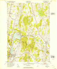 1948 Milton1953 Print · USGSThe Lamoille River valley in the late 1940s shows a landscape of rail-connected villages and rising hills on the Franklin and Chittenden county line. Trace local heritage at Bellows Free Academy, the Central Vermont Railway, and Hope Cem.5 unique versions available
 - 1948 Map of Jeffersonville, 1953 Print
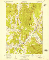 1948 Jeffersonville1953 Print · USGSVermont's Lamoille Valley in the late 1940s shows a landscape of river-bottom farming and mountain timbering. Trace the path of the St Johnsbury and Lamoille County railroad through Jeffersonville and Cambridge Junction.4 unique versions available
 - 1948 Map of Georgia Plains, 1953 Print
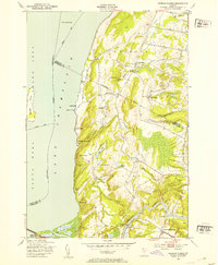 1948 Georgia Plains1953 Print · USGSCoastal Chittenden County is shown here in the late forties, where the eastern shore of Lake Champlain meets a landscape of quiet farms and summer camps. Genealogists and local historians can locate early schoolhouses like School No 8 and find the exact footprints of West Milton and Checkerberry Village.5 unique versions available
 - 1948 Map of Gilson Mountain, 1953 Print
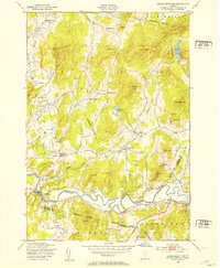 1948 Gilson Mountain1953 Print · USGSVermont's rural landscape is captured here in the late 1940s, showcasing a network of small upland hamlets and mountain farms. Genealogists and historians can trace family roots through numerous landmarks like Sanderson Cem, Parsons Sch, and the village of Binghamville.4 unique versions available
Showing maps 1-25 of 78
Top cities of Franklin County
- Saint Albans City historical maps
- Swanton historical maps
- Fairfax historical maps
- Richford historical maps
- Sheldon historical maps
- Fairfield historical maps
See more
Frequently asked questions
- What are the different types of historical maps available for Franklin County?
- What is the oldest map of Franklin County?
- Where can I purchase historical maps of Franklin County for my home or office?
- Where can I download high-res historical maps of Franklin County?
- Are there historical topographic maps available for Franklin County?
- Is there historical aerial imagery available for Franklin County?
- Where are historical maps of Franklin County sourced from?