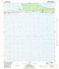
1980 Map of St. Andrews Bay
USGS Topo · Published 1980About this map
Mobile Bay dominates the northern reaches of this coastal survey, where the waters of the bay meet the northern edge of the Fort Morgan peninsula. The landscape is characterized by its transition from tidal flats and bayside marshes to the sandy reaches of the Gulf of Mexico. Settlement in the late 1970s was concentrated in small coastal pockets, including Weeks and Edith, which appear as discrete named locations along the peninsula's spine. The map reflects a moment in time when this portion of the Alabama coast remained relatively sparsely developed, with land use patterns primarily dictated by the immediate proximity to both the sheltered waters of the bay and the open Gulf.
Find a feature on this map
3 named features on this map. Tap any name to fly to it.
Don’t see what you’re looking for? This feature index may not catch every label — zoom into the map to look around manually.
Map Details
Editions of this 1980 St. Andrews Bay Map
This is the sole edition of this map. No revisions or reprints were ever made.
Other maps of this area

1921 · Point Clear
USGS Topo · 1:62,500

1921 · Dauphin Island
USGS Topo · 1:62,500

1921 · Delchamps
USGS Topo · 1:62,500

1941 · Cedar Point
USGS Topo · 1:62,500

1941 · Weeks Bay
USGS Topo · 1:62,500

1942 · Fort Morgan
USGS Topo · 1:62,500

1943 · Cedar Point
USGS Topo · 1:62,500

1943 · Weeks Bay
USGS Topo · 1:62,500

1953 · Mobile
USGS Topo · 1:250,000

1957 · Mobile
USGS Topo · 1:250,000