Loading...
Loading map...1956 Map of St. Augustine
USGS Topo · Published 1972About this map
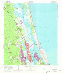
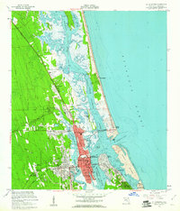
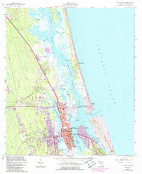
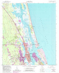
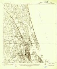
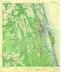
St Augustine serves as the focal point of this coastal landscape, revealing the historic layout of the city between the San Sebastian River and the Matanzas River. The map details significant cultural and institutional landmarks, from the Castillo de San Marcos National Mon at the water's edge to the State Deaf and Blind Institute and the Florida Industrial College. The transportation network is anchored by the Florida East Coast railroad and the iconic Bridge of Lions, which connects the mainland to Davis Shores and Anastasia.
Find a feature on this map
62 named features on this map. Tap any name to fly to it.
Don’t see what you’re looking for? This feature index may not catch every label — zoom into the map to look around manually.
Map Details
Date Portrayed1956
Date Published1972
PublisherU.S. Geological Survey
Map TypeTopographic
Scale1:24,000
Physical Dimensions23 x 26.9 inches
Editions of this 1956 St. Augustine Map
4 editions found
Historical Maps of Saint Augustine Through Time
3 maps found
Featured Locations
Source Details
SourceU.S. Geological Survey
CopyrightPublic Domain