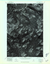
1975 Map of St Francis SW
USGS Topo · Published 1981About this map
The remote forestlands of northern Aroostook County are captured here in late October 1975, showing a landscape defined by dense timber and winding waterways. This orthophotoquad provides an unvarnished aerial perspective of the region just south of the Canadian border, where the terrain is dominated by a complex network of ridges and drainage basins. Visible features include the winding path of Negro Brook and the remote waters of Jones Mill in the eastern portion of the sheet. The imagery reveals the intensity of local logging operations, with a dense web of timber haul roads and clearings cutting through the heavy canopy. Unlike traditional topographic maps, this aerial view documents the literal state of the forest cover and the precise layout of access trails during the mid-1970s, making it a valuable tool for tracking changes in Maine's industrial woodlands.
Find a feature on this map
2 named features on this map. Tap any name to fly to it.
Don’t see what you’re looking for? This feature index may not catch every label — zoom into the map to look around manually.
Map Details
Editions of this 1975 St Francis SW Map
This is the sole edition of this map. No revisions or reprints were ever made.
Other maps of this area

1930 · Allagash
USGS Topo · 1:48,000

1930 · St Francis
USGS Topo · 1:48,000

1931 · Fish River Lake
USGS Topo · 1:48,000

1932 · Allagash Falls
USGS Topo · 1:48,000

1933 · Allagash
USGS Topo · 1:62,500

1933 · St Francis
USGS Topo · 1:62,500

1935 · Fish River Lake
USGS Topo · 1:62,500

1935 · Allagash Falls
USGS Topo · 1:62,500

1954 · Presque Isle
USGS Topo · 1:250,000

1956 · Allagash Falls
USGS Topo · 1:50,000