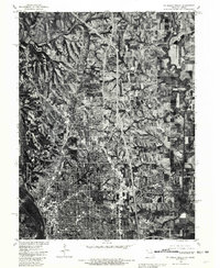
1980 Map of St. Joseph North
USGS Topo · Published 1981About this map
Country Club Village and the northern suburban expansion of St. Joseph dominate this 1980 orthophotomap, showing the residential density of the era juxtaposed against the surrounding agricultural landscape. The imagery, prepared by the U.S. Geological Survey in cooperation with the Soil Conservation Service, reveals the complex interplay of modern highway infrastructure and natural watercourses. The deeply meandering One Hundred and Two River snakes through the eastern section of the map, while the broad Missouri River defines the western edge. This specific edition uses rectified aerial photography to provide a clear view of land-use patterns, from the orderly residential grids of the city to the small outpost of Avenue City in the northeast. It serves as a visual bridge between the 1971 topographic land lines and the actual ground conditions at the start of the 1980s.
Find a feature on this map
4 named features on this map. Tap any name to fly to it.
Don’t see what you’re looking for? This feature index may not catch every label — zoom into the map to look around manually.
Map Details
Editions of this 1980 St. Joseph North Map
This is the sole edition of this map. No revisions or reprints were ever made.
Other maps of this area

1923 · Clarksdale
USGS Topo · 1:62,500

1924 · St. Joseph
USGS Topo · 1:62,500

1925 · Gower
USGS Topo · 1:62,500

1925 · Clarksdale
USGS Topo · 1:62,500

1926 · Saint Joseph
USGS Topo · 1:62,500

1927 · Dearborn
USGS Topo · 1:62,500

1950 · Kansas City
USGS Topo · 1:250,000

1954 · Kansas City
USGS Topo · 1:250,000

1956 · Kansas City
USGS Topo · 1:250,000

1960 · Kansas City
USGS Topo · 1:250,000