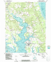
1987 Map of St. Marys City
USGS Topo · Published 1987About this map
The St Marys City shoreline along the St Marys River reveals a landscape defined by tidewater history and maritime operations in the late 1980s. This study documents the historic heart of Maryland's first capital, preserved within the St Marys City Historic Park and the campus of St Marys College. The geography is intricately carved by numerous coves and points, such as Church Pt and Chancellor Pt, which served as critical access points for the region's river-based commerce. To the south, the U S Naval Reservation (Webster Field) occupies a significant peninsula, illustrating the continued strategic importance of the St. Marys peninsula. Smaller settlements like Park Hall, Hermanville, and St Inigoes are connected by a network of rural roads including Mattapany Road and Hermanville Road, while the waters of the Potomac River and Chesapeake Bay frame the southern and eastern edges of the county.
Find a feature on this map
121 named features on this map. Tap any name to fly to it.
Don’t see what you’re looking for? This feature index may not catch every label — zoom into the map to look around manually.
Map Details
Editions of this 1987 St. Marys City Map
2 editions found
Other maps of this area

1892 · Leonardtown
USGS Topo · 1:62,500

1892 · Drum Point
USGS Topo · 1:62,500

1892 · Piney Point
USGS Topo · 1:62,500

1894 · Piney Point
USGS Topo · 1:62,500

1894 · Point Lookout
USGS Topo · 1:62,500

1895 · Leonardtown
USGS Topo · 1:62,500

1895 · Nomini
USGS Topo · 1:125,000

1895 · Piney Point
USGS Topo · 1:62,500

1898 · Nomini
USGS Topo · 1:125,000

1898 · St. Marys
USGS Topo · 1:125,000