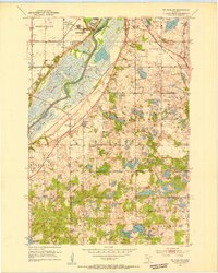
1951 Map of St. Paul SW
USGS Topo · Published 1953About this map
The Minnesota River corridor south of the Twin Cities defines this early 1950s landscape, characterized by vast wetlands like Long Meadow Lake and Black Dog Lake. At the northern edge, the Fort Snelling Reservation and the expansive Fort Snelling National Cemetery stand as significant landmarks of military and civic heritage. This period shows the transition of townships such as Bloomington, Eagan, and Burnsville before their rapid post-war suburban transformation, still dominated by section-line roads, small schools like School No 12, and rural identifiers like Nicols.
Find a feature on this map
40 named features on this map. Tap any name to fly to it.
Don’t see what you’re looking for? This feature index may not catch every label — zoom into the map to look around manually.
Map Details
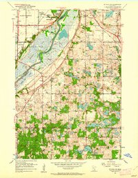
Editions of this 1951 St. Paul SW Map
3 editions found
Other maps of this area

1896 · Minneapolis
USGS Topo · 1:62,500

1896 · St. Paul
USGS Topo · 1:62,500

1901 · Minneapolis
USGS Topo · 1:62,500

1951 · St. Paul West
USGS Topo · 1:24,000

1951 · Inver Grove
USGS Topo · 1:24,000

1951 · St. Paul SW
USGS Topo · 1:24,000

1951 · St. Paul East
USGS Topo · 1:24,000

1951 · St. Paul
USGS Topo · 1:62,500

1952 · Minneapolis South
USGS Topo · 1:24,000

1953 · Saint Paul
USGS Topo · 1:250,000