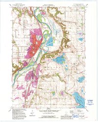
1991 Map of St Peter
USGS Topo · Published 1995About this map
The Minnesota River carves a deep valley through this landscape, separating the developed bench of St Peter from the high prairies of Ottawa and Sharon. In the late 20th century, the city shows significant institutional growth, anchored by the campus of Gustavus Adolphus College and the expansive St Peter State Hospital complex. Evidence of the region’s earlier frontier history is preserved at the Traverse Des Sioux Wayside Park and along the historic alignment of Old Fort Road.
Find a feature on this map
49 named features on this map. Tap any name to fly to it.
Don’t see what you’re looking for? This feature index may not catch every label — zoom into the map to look around manually.
Map Details
Editions of this 1991 St Peter Map
2 editions found
Other maps of this area

1950 · Mankato East
USGS Topo · 1:62,500

1951 · Mankato East
USGS Topo · 1:62,500

1951 · Mankato West
USGS Topo · 1:62,500

1953 · Saint Paul
USGS Topo · 1:250,000

1953 · New Ulm
USGS Topo · 1:250,000

1957 · New Ulm
USGS Topo · 1:250,000

1958 · New Ulm
USGS Topo · 1:250,000

1959 · Saint Paul
USGS Topo · 1:250,000

1965 · Cleveland
USGS Topo · 1:24,000

1965 · Norseland
USGS Topo · 1:24,000