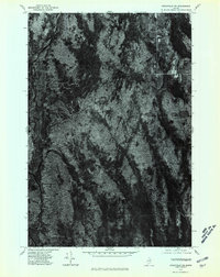
1975 Map of Stacyville NE
USGS Topo · Published 1980About this map
The dense forests of Penobscot County dominate this 1975 aerial orthophotograph, centered on a remote landscape of winding watercourses and timberlands. A major River and smaller Stream networks cut through the canopy, illustrating the drainage patterns that have shaped Maine's interior. The most prominent human landmark is Lunksoos Camp, situated near the water's edge in the southwestern portion of the sheet. Unlike a traditional line-drawn map, this photographic survey provides a direct view of the forest density and land clearing as it existed in the mid-1970s, capturing the specific texture of the woods and the few primitive roads or trails that pierce the wilderness. It serves as a clear record of the area's geography before decades of subsequent forest growth and shifting land use.
Find a feature on this map
3 named features on this map. Tap any name to fly to it.
Don’t see what you’re looking for? This feature index may not catch every label — zoom into the map to look around manually.
Map Details
Editions of this 1975 Stacyville NE Map
This is the sole edition of this map. No revisions or reprints were ever made.
Other maps of this area

1940 · Island Falls
USGS Topo · 1:62,500

1940 · Sherman
USGS Topo · 1:62,500

1942 · Island Falls
USGS Topo · 1:62,500

1942 · Sherman
USGS Topo · 1:62,500

1953 · Stacyville
USGS Topo · 1:62,500

1954 · Shin Pond
USGS Topo · 1:62,500

1954 · Presque Isle
USGS Topo · 1:250,000

1954 · Millinocket
USGS Topo · 1:250,000

1958 · Presque Isle
USGS Topo · 1:250,000

1958 · Millinocket
USGS Topo · 1:250,000