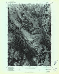
1975 Map of Stacyville NW
USGS Topo · Published 1980About this map
Lunksoos Mountain stands as a prominent elevation in this mid-1970s orthophotoquad, overlooking a landscape defined by the convergence of major waterways in the North Maine Woods. The winding course of the East Branch Penobscot River cuts through the northern half of the sheet, eventually meeting the substantial Wassataquoik Stream which flows from the southwest. This imagery, captured from 1975 aerial photography, reveals the dense timber patterns and water-driven geography of the Penobscot watershed. Smaller tributaries like Deasey Brook further define the drainage patterns of this region, providing a visual record of the forest and river systems before modern changes in land management and recreation.
Find a feature on this map
4 named features on this map. Tap any name to fly to it.
Don’t see what you’re looking for? This feature index may not catch every label — zoom into the map to look around manually.
Map Details
Editions of this 1975 Stacyville NW Map
This is the sole edition of this map. No revisions or reprints were ever made.
Other maps of this area

1927 · Katahdin
USGS Topo · 1:48,000

1930 · Katahdin
USGS Topo · 1:62,500

1949 · Katahdin
USGS Topo · 1:62,500

1953 · Stacyville
USGS Topo · 1:62,500

1954 · Shin Pond
USGS Topo · 1:62,500

1954 · Presque Isle
USGS Topo · 1:250,000

1954 · Millinocket
USGS Topo · 1:250,000

1955 · Traveler Mountain
USGS Topo · 1:62,500

1958 · Presque Isle
USGS Topo · 1:250,000

1958 · Millinocket
USGS Topo · 1:250,000