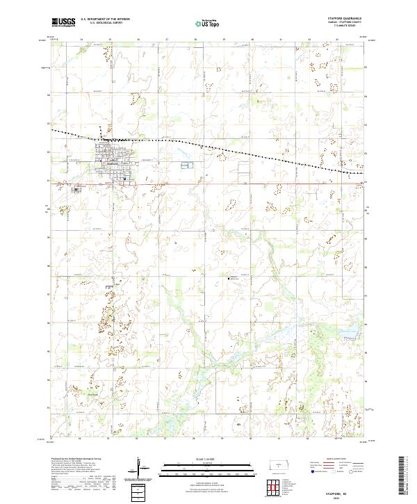
2022 Map of Stafford
USGS Topo · Published 2022About this map
The town of Stafford serves as the central hub of this South Central Kansas landscape, defined by a grid of agricultural section lines and the winding paths of the N Fork Ninnescah River and S Fork Ninnescah River. The community's local history is anchored at the Stafford Cem on the western edge of town and the Pleasant Valley Cem further southeast. The terrain is marked by significant hydrological features including Dooleyville Cr, Peace Cr, and the isolated waters of Rosacker Lake. A unique topographic landmark, Pilot Knob, rises in the southwest, providing a distinct break in the prairie geometry. The map detail extends to the individual streets of the town center, naming thoroughfares such as E Broadway St and Martin Ave, which reflect the early development patterns of this Stafford County seat.
Find a feature on this map
62 named features on this map. Tap any name to fly to it.
Don’t see what you’re looking for? This feature index may not catch every label — zoom into the map to look around manually.
Map Details
Editions of this 2022 Stafford Map
This is the sole edition of this map. No revisions or reprints were ever made.
Other maps of this area

1891 · Great Bend
USGS Topo · 1:125,000

1892 · Kingman
USGS Topo · 1:125,000

1892 · Pratt
USGS Topo · 1:125,000

1893 · Great Bend
USGS Topo · 1:125,000

1894 · Kingman
USGS Topo · 1:125,000

1894 · Pratt
USGS Topo · 1:125,000

1894 · Lyons
USGS Topo · 1:125,000

1955 · Great Bend
USGS Topo · 1:250,000

1955 · Pratt
USGS Topo · 1:250,000

1957 · Great Bend
USGS Topo · 1:250,000