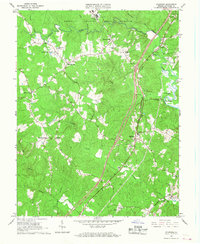
1966 Map of Stafford
USGS Topo · Published 1967About this map
Quantico Marine Corps Schools dominate the northern landscape of this mid-1960s survey, illustrating the significant military presence in the area with Camp Barrett and an observation tower overlooking the drainages of Aquia Creek. The transportation network is defined by the Richmond Fredericksburg and Potomac railroad and the burgeoning suburban development of Garrisonville Estates and Sheltons Shop.
Find a feature on this map
44 named features on this map. Tap any name to fly to it.
Don’t see what you’re looking for? This feature index may not catch every label — zoom into the map to look around manually.
Map Details
Editions of this 1966 Stafford Map
4 editions found
Other maps of this area

1887 · Spottsylvania
USGS Topo · 1:125,000

1889 · Fredericksburg
USGS Topo · 1:125,000

1890 · Mt. Vernon
USGS Topo · 1:125,000

1891 · Mt. Vernon
USGS Topo · 1:125,000

1892 · Fredericksburg
USGS Topo · 1:125,000

1892 · Spottsylvania
USGS Topo · 1:125,000

1894 · Warrenton
USGS Topo · 1:125,000

1894 · Fredericksburg
USGS Topo · 1:125,000

1894 · Mt. Vernon
USGS Topo · 1:125,000

1897 · Mt. Vernon
USGS Topo · 1:125,000