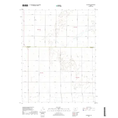
2018 Map of Stafford SW
USGS Topo · Published 2018About this map
The N Fork Ninnescah River meanders across the rural landscape along the border of Stafford Co and Pratt Co. This 2018 survey reveals a terrain defined by agricultural grid patterns and natural hydrological features, including numerous small wetlands and depressions that dot the central and eastern portions of the quadrangle. Genealogical interest centers on the Valley Cem located near the northern edge of the map, a quiet marker of the local community's history. The infrastructure is characterized by an extensive network of range and township roads, such as SE 90th St and Co Rd A, which delineate the section lines of this prairie region. These routes, including NE 110th St and Co Rd E, provide a clear picture of the land division and access points across the Kansas plains during the early 21st century.
Find a feature on this map
24 named features on this map. Tap any name to fly to it.
Don’t see what you’re looking for? This feature index may not catch every label — zoom into the map to look around manually.
Map Details
Editions of this 2018 Stafford SW Map
This is the sole edition of this map. No revisions or reprints were ever made.
Other maps of this area

1892 · Pratt
USGS Topo · 1:125,000

1894 · Pratt
USGS Topo · 1:125,000

1955 · Pratt
USGS Topo · 1:250,000

1959 · Pratt
USGS Topo · 1:250,000

1967 · Cairo
USGS Topo · 1:24,000

1968 · Pratt
USGS Topo · 1:24,000

1968 · Coats NE
USGS Topo · 1:24,000
1971 · Preston
USGS Topo · 1:24,000

1971 · Stafford
USGS Topo · 1:24,000
1971 · Byers
USGS Topo · 1:24,000