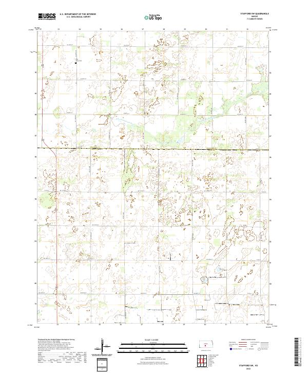
2022 Map of Stafford SW
USGS Topo · Published 2022About this map
The N Fork Ninnescah River meanders across the upper half of this Kansas landscape, carving a subtle path through the agricultural grid of the High Plains. Located on the northern edge of the survey, the Rose Valley Cem serves as a small but significant landmark for those tracing local family histories in this rural region. The map captures the dividing line of the Stafford Co Pratt Co boundary, which splits the terrain into distinct townships including t25s r13w and t26s r12w. This area is defined by its extensive network of section roads like SE 90th St and 110th St, reflecting a well-established pattern of land division and rural transport that supports the surrounding farmsteads.
Find a feature on this map
25 named features on this map. Tap any name to fly to it.
Don’t see what you’re looking for? This feature index may not catch every label — zoom into the map to look around manually.
Map Details
Editions of this 2022 Stafford SW Map
This is the sole edition of this map. No revisions or reprints were ever made.
Other maps of this area

1892 · Pratt
USGS Topo · 1:125,000

1894 · Pratt
USGS Topo · 1:125,000

1955 · Pratt
USGS Topo · 1:250,000

1959 · Pratt
USGS Topo · 1:250,000

1967 · Cairo
USGS Topo · 1:24,000

1968 · Pratt
USGS Topo · 1:24,000

1968 · Coats NE
USGS Topo · 1:24,000
1971 · Preston
USGS Topo · 1:24,000

1971 · Stafford
USGS Topo · 1:24,000
1971 · Byers
USGS Topo · 1:24,000