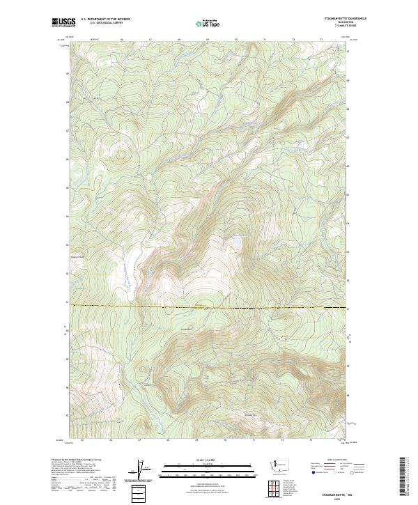
2023 Map of Stagman Butte
USGS Topo · Published 2023About this map
Stagman Butte and the high ridges of the Yakima region dominate this landscape, which straddles the boundary between Yakima and Klickitat counties. This part of the Yakama Indian Reservation is defined by a dense network of Bureau of Indian Affairs (BIA) routes, such as Bia RD 119 and Bia RD 248, which wind through the drainage basins of North Fork Logy Creek and South Fork Logy Creek. The high elevations are marked by distinctive landmarks like Simcoe Mtn and Castle Rock, while smaller water features like Tadpole Lake and Spring Creek punctuate the upland terrain. The presence of the Satus Ranger Station Rd and Lakebeds Rd reflects the administrative and forest management history of the area, providing a detailed look at the infrastructure within these tribal lands.
Find a feature on this map
30 named features on this map. Tap any name to fly to it.
Don’t see what you’re looking for? This feature index may not catch every label — zoom into the map to look around manually.
Map Details
Editions of this 2023 Stagman Butte Map
This is the sole edition of this map. No revisions or reprints were ever made.
Other maps of this area

1937 · White Swan
USGS Topo · 1:125,000

1950 · Yakima
USGS Topo · 1:250,000

1953 · The Dalles
USGS Topo · 1:250,000

1956 · The Dalles
USGS Topo · 1:250,000

1957 · The Dalles
USGS Topo · 1:250,000

1957 · Goldendale
USGS Topo · 1:62,500

1957 · Satus Pass
USGS Topo · 1:62,500

1958 · Yakima
USGS Topo · 1:250,000

1961 · Yakima
USGS Topo · 1:250,000
1965 · Logy Creek
USGS Topo · 1:62,500