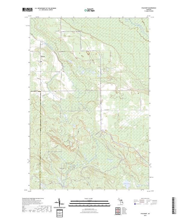
2023 Map of Stalwart
USGS Topo · Published 2023About this map
Stalwart anchors this portion of the eastern Upper Peninsula, situated at the intersection of E M 48 and S Reynolds RD. The terrain is defined by a vast network of wetlands, including the expansive Gogomain Swamp and numerous small water bodies like Covach Lake and McAdams Lake. This 2023 survey illustrates the modern transition from the agricultural clearings near the Stalwart Cem to the dense, low-lying drainage basins of the South Branch Gogomain River and Beaver Tail Creek. Recreation and timber access are evident through a grid of secondary roads and dedicated paths such as the Birch Hill Motorcycle Trl and Foreman Lake Motorcycle Trl, which wind through the elevations of Birch Hill and Hungry Hill. The boundary between Mackinac Co and Chippewa Co cuts vertically through the landscape, marking a jurisdictional divide in this rural forested region.
Find a feature on this map
38 named features on this map. Tap any name to fly to it.
Don’t see what you’re looking for? This feature index may not catch every label — zoom into the map to look around manually.
Map Details
Editions of this 2023 Stalwart Map
This is the sole edition of this map. No revisions or reprints were ever made.
Other maps of this area

1931 · Pickford SE
USGS Topo · 1:31,680

1953 · Munuscong
USGS Topo · 1:24,000

1953 · Munuscong NE
USGS Topo · 1:24,000
1953 · Pickford
USGS Topo · 1:24,000

1954 · Sault Sainte Marie
USGS Topo · 1:250,000

1955 · Cheboygan
USGS Topo · 1:250,000

1956 · Sault Sainte Marie
USGS Topo · 1:250,000

1957 · Sault Sainte Marie
USGS Topo · 1:250,000

1958 · Cheboygan
USGS Topo · 1:250,000

1958 · Sault Sainte Marie
USGS Topo · 1:250,000