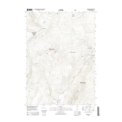
2015 Map of Stamford
USGS Topo · Published 2015About this map
Stamford and the Village of Alpenwald are central to this landscape in the Green Mountain National Forest. The terrain is defined by the high elevations of the Hoosac Range and the Stamford and Woodford Plateau, with the Appalachian National Scenic Trail winding through the western ridges near Scrub Hill. The drainage patterns are complex, featuring the N Br Hoosic River flowing south and several branches of the West Branch Deerfield River carving through the mountains to the north. For genealogists and local historians, the Houghton Cem near Henry Hill and the established settlement of Heartwellville provide specific points of reference for tracing family roots in this corner of Bennington County. Local roads such as Old Co Rd and Maltese Rd suggest older thoroughfares connecting these mountain communities.
Find a feature on this map
55 named features on this map. Tap any name to fly to it.
Don’t see what you’re looking for? This feature index may not catch every label — zoom into the map to look around manually.
Map Details
Editions of this 2015 Stamford Map
This is the sole edition of this map. No revisions or reprints were ever made.
Other maps of this area

1886 · Greylock
USGS Topo · 1:62,500

1886 · Hawley
USGS Topo · 1:62,500

1889 · Wilmington
USGS Topo · 1:62,500

1890 · Hawley
USGS Topo · 1:62,500

1891 · Wilmington
USGS Topo · 1:62,500

1891 · Greylock
USGS Topo · 1:62,500

1893 · Greylock
USGS Topo · 1:62,500

1894 · Hawley
USGS Topo · 1:62,500

1898 · Bennington
USGS Topo · 1:62,500

1898 · Greylock
USGS Topo · 1:62,500