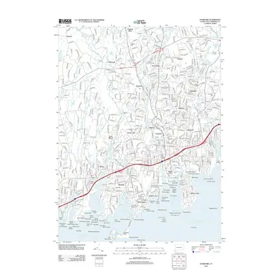
2012 Map of Stamford
USGS Topo · Published 2012About this map
Shippan Point and the complex shoreline of Long Island Sound define the southern reaches of this Stamford survey, where the Rippowam River meets the tide at Stamford Harbor Lighthouse. The map details a dense suburban landscape transitioning into the coastal neighborhoods of Old Greenwich and Riverside. This 2012 snapshot of Fairfield County shows the modern alignment of the Metro-North Railroad and I-95 as they corridor through the commercial heart of the city near the Main Street Bridge.
Find a feature on this map
136 named features on this map. Tap any name to fly to it.
Don’t see what you’re looking for? This feature index may not catch every label — zoom into the map to look around manually.
Map Details
Editions of this 2012 Stamford Map
This is the sole edition of this map. No revisions or reprints were ever made.
Other maps of this area

1892 · Stamford
USGS Topo · 1:62,500

1892 · Norwalk
USGS Topo · 1:62,500

1893 · Stamford
USGS Topo · 1:62,500

1893 · Norwalk
USGS Topo · 1:62,500

1897 · Oyster Bay
USGS Topo · 1:62,500

1898 · Oyster Bay
USGS Topo · 1:62,500

1899 · Stamford
USGS Topo · 1:62,500

1900 · Oyster Bay
USGS Topo · 1:62,500

1901 · Northport
USGS Topo · 1:62,500

1903 · Northport
USGS Topo · 1:62,500