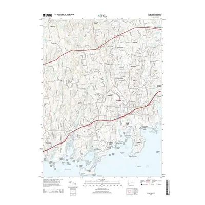
2015 Map of Stamford
USGS Topo · Published 2015About this map
Stamford and its surrounding coastal communities are captured here along the Long Island Sound, showing a landscape defined by industrial heritage and dense residential development. The shoreline is a complex network of inlets and points, featuring Shippan Point, Greenwich Point, and the busy waters of Stamford Harbor. The New York New Haven and Hartford RR corridor serves as a primary spine through the region, connecting established neighborhoods like Glenbrook, Springdale, and Old Greenwich.
Find a feature on this map
138 named features on this map. Tap any name to fly to it.
Don’t see what you’re looking for? This feature index may not catch every label — zoom into the map to look around manually.
Map Details
Editions of this 2015 Stamford Map
This is the sole edition of this map. No revisions or reprints were ever made.
Other maps of this area

1892 · Stamford
USGS Topo · 1:62,500

1892 · Norwalk
USGS Topo · 1:62,500

1893 · Stamford
USGS Topo · 1:62,500

1893 · Norwalk
USGS Topo · 1:62,500

1897 · Oyster Bay
USGS Topo · 1:62,500

1898 · Oyster Bay
USGS Topo · 1:62,500

1899 · Stamford
USGS Topo · 1:62,500

1900 · Oyster Bay
USGS Topo · 1:62,500

1901 · Northport
USGS Topo · 1:62,500

1903 · Northport
USGS Topo · 1:62,500