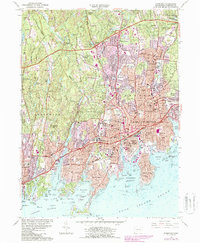
1987 Map of Stamford
USGS Topo · Published 1987About this map
The coastal corridor of Fairfield County is depicted here in a period of intense post-war suburban and industrial maturity. Stamford serves as the central hub, shown with its dense network of infrastructure including the Connecticut Turnpike, Amtrak and Conrail lines, and maritime facilities surrounding Stamford Harbor. The landscape transitions from the developed South End and Glenbrook to the more wooded, residential areas around Hunting Ridge and Stanwich in the north.
Find a feature on this map
121 named features on this map. Tap any name to fly to it.
Don’t see what you’re looking for? This feature index may not catch every label — zoom into the map to look around manually.
Map Details
Editions of this 1987 Stamford Map
This is the sole edition of this map. No revisions or reprints were ever made.
Other maps of this area

1892 · Stamford
USGS Topo · 1:62,500

1892 · Norwalk
USGS Topo · 1:62,500

1893 · Stamford
USGS Topo · 1:62,500

1893 · Norwalk
USGS Topo · 1:62,500

1897 · Oyster Bay
USGS Topo · 1:62,500

1898 · Oyster Bay
USGS Topo · 1:62,500

1899 · Stamford
USGS Topo · 1:62,500

1900 · Oyster Bay
USGS Topo · 1:62,500

1901 · Northport
USGS Topo · 1:62,500

1903 · Northport
USGS Topo · 1:62,500