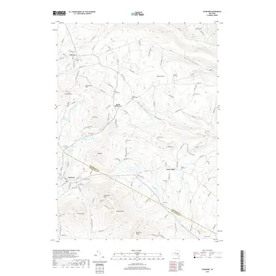
2019 Map of Stamford
USGS Topo · Published 2019About this map
Utsayantha Mtn and the Moresville Range dominate the southern portion of this landscape, where the Schoharie and Delaware county line divides the high ground. The village of Stamford serves as a local hub near the headwaters of the W Br Delaware River, while the northern region is defined by the agricultural and woodland clearings surrounding Jefferson and South Jefferson.
Find a feature on this map
130 named features on this map. Tap any name to fly to it.
Don’t see what you’re looking for? This feature index may not catch every label — zoom into the map to look around manually.
Map Details
Editions of this 2019 Stamford Map
This is the sole edition of this map. No revisions or reprints were ever made.
Other maps of this area

1898 · Schoharie
USGS Topo · 1:62,500

1900 · Schoharie
USGS Topo · 1:62,500

1901 · Gilboa
USGS Topo · 1:62,500

1903 · Gilboa
USGS Topo · 1:62,500

1904 · Richmondville
USGS Topo · 1:62,500

1904 · Hobart
USGS Topo · 1:62,500

1943 · Breakabeen
USGS Topo · 1:24,000

1943 · Charlotteville
USGS Topo · 1:24,000

1943 · Summit
USGS Topo · 1:24,000
1945 · Summit
USGS Topo · 1:31,680