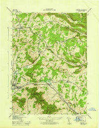
1946 Map of Stamford
USGS Topo · Published 1946About this map
Stamford and Jefferson anchor this mid-1940s topography, illustrating the high-country landscape of the Schoharie and Delaware County border. The New York Central railroad follows the valley floor, passing through the South Gilboa Sta and connecting the village of Stamford to the broader regional economy. The terrain is defined by prominent peaks like Utsayantha Mtn and Bald Mtn, which overlook a network of narrow hollows such as Whiting Hollow and Darling Hollow.
Find a feature on this map
56 named features on this map. Tap any name to fly to it.
Don’t see what you’re looking for? This feature index may not catch every label — zoom into the map to look around manually.
Map Details
Editions of this 1946 Stamford Map
This is the sole edition of this map. No revisions or reprints were ever made.
Other maps of this area

1898 · Schoharie
USGS Topo · 1:62,500

1900 · Schoharie
USGS Topo · 1:62,500

1901 · Gilboa
USGS Topo · 1:62,500

1903 · Gilboa
USGS Topo · 1:62,500

1904 · Richmondville
USGS Topo · 1:62,500

1904 · Hobart
USGS Topo · 1:62,500

1943 · Breakabeen
USGS Topo · 1:24,000

1943 · Charlotteville
USGS Topo · 1:24,000

1943 · Summit
USGS Topo · 1:24,000
1945 · Summit
USGS Topo · 1:31,680