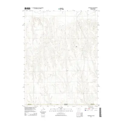
2014 Map of Stamford SE
USGS Topo · Published 2014About this map
Home Cem and Lutheran Cem sit among the rolling high plains along the Nebraska-Kansas border, marking the early settlement history of this rural frontier. The landscape is defined by the drainage of Sappa Cr and its tributaries, including Twin Cr and Spring Brook, which cut through the terrain south of Sappa Peak. This 2014 survey reveals a sparsely populated agricultural region in Phillips County, where the most significant infrastructure is found along W Arrow Rd and the localized collection of water at Lubeck Reservoir. The proximity of these two cemeteries near the state line suggests a community linked across political boundaries by shared local heritage and long-standing family homesteads.
Find a feature on this map
10 named features on this map. Tap any name to fly to it.
Don’t see what you’re looking for? This feature index may not catch every label — zoom into the map to look around manually.
Map Details
Editions of this 2014 Stamford SE Map
This is the sole edition of this map. No revisions or reprints were ever made.
Other maps of this area

1893 · Norton
USGS Topo · 1:125,000

1893 · Phillipsburg
USGS Topo · 1:125,000

1896 · Holdrege
USGS Topo · 1:125,000

1896 · Arapahoe
USGS Topo · 1:125,000

1898 · Arapahoe
USGS Topo · 1:125,000

1955 · Grand Island
USGS Topo · 1:250,000

1955 · Beloit
USGS Topo · 1:250,000

1957 · Grand Island
USGS Topo · 1:250,000

1957 · Precept
USGS Topo · 1:24,000

1957 · Stamford SE
USGS Topo · 1:24,000