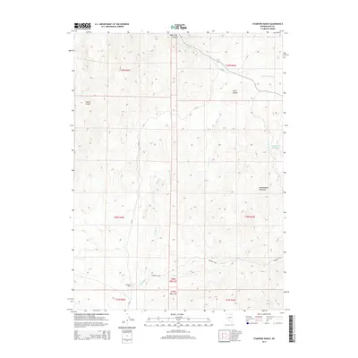
2014 Map of Stampede Ranch
USGS Topo · Published 2014About this map
Independence Mountains topography dominates this section of Elko County, where high ridges give way to a network of drainage basins. The area's ranching heritage is anchored by Stampede Ranch, located near the southern convergence of several waterways including Maggie Cr and Coon Cr. The landscape is defined by deep cuts such as Water Pipe Canyon and Taylor Canyon, which channel seasonal runoff from the higher elevations toward the valley floors. These natural features, combined with the presence of the Eagle Rock Reservoir, reflect the vital importance of water management in this high-desert environment. The primary artery through this terrain is CR-736, which follows the contours of the land, connecting the various canyons and creeks that serve the local cattle industry and remote outposts.
Find a feature on this map
23 named features on this map. Tap any name to fly to it.
Don’t see what you’re looking for? This feature index may not catch every label — zoom into the map to look around manually.
Map Details
Editions of this 2014 Stampede Ranch Map
This is the sole edition of this map. No revisions or reprints were ever made.
Other maps of this area

1955 · McDermitt
USGS Topo · 1:250,000

1955 · Wells
USGS Topo · 1:250,000

1956 · Tuscarora
USGS Topo · 1:62,500

1958 · Wells
USGS Topo · 1:250,000

1958 · Singletree Creek
USGS Topo · 1:24,000

1958 · Blue Basin
USGS Topo · 1:24,000

1959 · McDermitt
USGS Topo · 1:250,000

1961 · Wells
USGS Topo · 1:250,000

1970 · Lake Mountain
USGS Topo · 1:24,000

1970 · Stampede Ranch
USGS Topo · 1:24,000