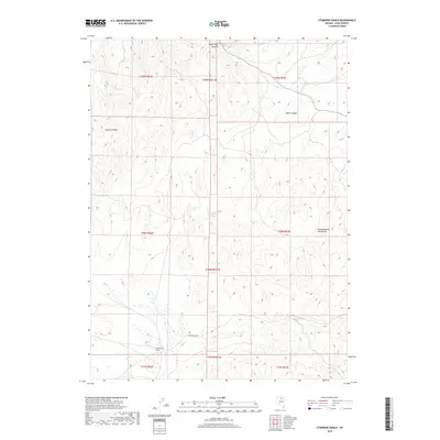
2018 Map of Stampede Ranch
USGS Topo · Published 2018About this map
Stampede Ranch serves as the primary landmark in this high-desert region of Elko County, situated along the drainages of Coon Cr and Dip Cr. The terrain is defined by the significant rise of the Independence Mountains to the east, which dictate the drainage patterns of several seasonal and perennial waterways. Narrow passages through the high ground include Coyote Canyon and Water Pipe Canyon, the latter of which is fed by Water Pipe Cr. The map shows a landscape of expansive ranching tracts and complex drainage systems, such as Maggie Cr, where the valley floor meets the foothills. This 2018 survey documents the persistent ranching layout and hydrography of the Great Basin, reflecting the intersection of livestock operations and the water resources required to sustain them in an arid environment.
Find a feature on this map
19 named features on this map. Tap any name to fly to it.
Don’t see what you’re looking for? This feature index may not catch every label — zoom into the map to look around manually.
Map Details
Editions of this 2018 Stampede Ranch Map
This is the sole edition of this map. No revisions or reprints were ever made.
Other maps of this area

1955 · McDermitt
USGS Topo · 1:250,000

1955 · Wells
USGS Topo · 1:250,000

1956 · Tuscarora
USGS Topo · 1:62,500

1958 · Wells
USGS Topo · 1:250,000

1958 · Singletree Creek
USGS Topo · 1:24,000

1958 · Blue Basin
USGS Topo · 1:24,000

1959 · McDermitt
USGS Topo · 1:250,000

1961 · Wells
USGS Topo · 1:250,000

1970 · Lake Mountain
USGS Topo · 1:24,000

1970 · Stampede Ranch
USGS Topo · 1:24,000