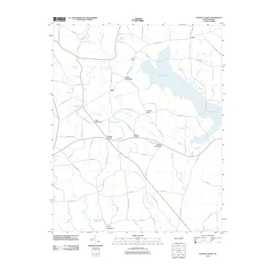
2010 Map of Stancils Chapel
USGS Topo · Published 2010About this map
Buckhorn Lake dominates the northeastern landscape of this Johnston County region, fed by several smaller waterways including Moccasin Creek and Bull Branch. The area is defined by its numerous crossroads communities and rural gatherings, such as Stilleys Crossroads and Dixie Crossroads. These nodes often developed around local landmarks or places of worship, evidenced by the central positions of Stancils Chapel and Moores Chapel.
Find a feature on this map
77 named features on this map. Tap any name to fly to it.
Don’t see what you’re looking for? This feature index may not catch every label — zoom into the map to look around manually.
Map Details
Editions of this 2010 Stancils Chapel Map
This is the sole edition of this map. No revisions or reprints were ever made.
Other maps of this area

1902 · Kenly
USGS Topo · 1:62,500

1902 · Spring Hope
USGS Topo · 1:62,500

1903 · Kenly
USGS Topo · 1:62,500

1904 · Springhope
USGS Topo · 1:62,500

1953 · Raleigh
USGS Topo · 1:250,000

1954 · Raleigh
USGS Topo · 1:250,000

1964 · Flowers
USGS Topo · 1:24,000

1964 · Selma
USGS Topo · 1:62,500

1964 · Selma
USGS Topo · 1:24,000
1968 · Zebulon
USGS Topo · 1:24,000