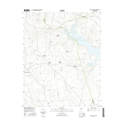
2016 Map of Stancils Chapel
USGS Topo · Published 2016About this map
Stancils Chapel and Moores Chapel anchor the rural landscape of eastern Johnston County, where the terrain is defined by the winding course of Moccasin Cr and the expansive Buckhorn Reservoir. This survey reflects a region of North Carolina where transportation networks are built around historic gathering points, evidenced by the numerous named junctions such as Dixie Crossroads, Stilleys Crossroads, and Hares Crossroads. These points of interest, along with the settlement at Heflin, indicate a long-standing agricultural and community structure that persisted into the twenty-first century. Genealogists and local historians can locate specific landmarks such as Shoeheel Cem and follow the boundaries separating Johnston, Nash, and Wilson Counties. The map also details several smaller water bodies, including Silver Lake, Parkers Pond, and Flowers Pond Number One, which dot the landscape alongside the Little River.
Find a feature on this map
94 named features on this map. Tap any name to fly to it.
Don’t see what you’re looking for? This feature index may not catch every label — zoom into the map to look around manually.
Map Details
Editions of this 2016 Stancils Chapel Map
This is the sole edition of this map. No revisions or reprints were ever made.
Other maps of this area

1902 · Kenly
USGS Topo · 1:62,500

1902 · Spring Hope
USGS Topo · 1:62,500

1903 · Kenly
USGS Topo · 1:62,500

1904 · Springhope
USGS Topo · 1:62,500

1953 · Raleigh
USGS Topo · 1:250,000

1954 · Raleigh
USGS Topo · 1:250,000

1964 · Flowers
USGS Topo · 1:24,000

1964 · Selma
USGS Topo · 1:62,500

1964 · Selma
USGS Topo · 1:24,000
1968 · Zebulon
USGS Topo · 1:24,000