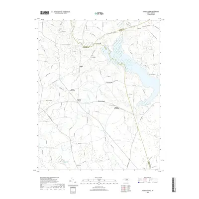
2019 Map of Stancils Chapel
USGS Topo · Published 2019About this map
Stancils Chapel and Moores Chapel serve as anchors for this rural landscape where Johnston, Nash, and Wilson counties meet. The geography is defined by the significant expansion of the Buckhorn Reservoir and the meandering paths of Moccasin Cr and Little Buffalo Cr. This 2019 survey illustrates a region where established agricultural crossroads like Stilleys Crossroads and Moores Crossroads remain central to the local identity. Genealogists may find interest in the documented Shoheel Cem or family-named landmarks like Parkers Pond and Flowers Pond Number One. The map provides a contemporary view of small settlements including Heflin and Crockers Nub, illustrating the persistent network of county roads and creek-fed ponds that have shaped this North Carolina coastal plain community for generations.
Find a feature on this map
99 named features on this map. Tap any name to fly to it.
Don’t see what you’re looking for? This feature index may not catch every label — zoom into the map to look around manually.
Map Details
Editions of this 2019 Stancils Chapel Map
This is the sole edition of this map. No revisions or reprints were ever made.
Other maps of this area

1902 · Kenly
USGS Topo · 1:62,500

1902 · Spring Hope
USGS Topo · 1:62,500

1903 · Kenly
USGS Topo · 1:62,500

1904 · Springhope
USGS Topo · 1:62,500

1953 · Raleigh
USGS Topo · 1:250,000

1954 · Raleigh
USGS Topo · 1:250,000

1964 · Flowers
USGS Topo · 1:24,000

1964 · Selma
USGS Topo · 1:62,500

1964 · Selma
USGS Topo · 1:24,000
1968 · Zebulon
USGS Topo · 1:24,000