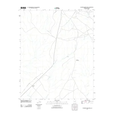
2011 Map of Standing Horse Mesa
USGS Topo · Published 2011About this map
The Borderland Trading Post serves as a lone commercial anchor in this high desert landscape, situated at the junction of the Winslow-Polacca Rd and Indian Rte 9840. The topography is dominated by the broad uplift of Standing Horse Mesa, an area defined by its complex drainage network where ephemeral streams like Fern Feather Wash and Humpy Wash carve intricate paths through the terrain. Evidence of water management and local travel is scattered across the quadrangle, notably at Lewis Well and several connecting routes including Indian Rte 80 and Indian Rte 603. The map illustrates a high-desert environment where habitation is sparse and life revolves around critical water sources and the road networks that facilitate movement between trading points.
Find a feature on this map
9 named features on this map. Tap any name to fly to it.
Don’t see what you’re looking for? This feature index may not catch every label — zoom into the map to look around manually.
Map Details
Editions of this 2011 Standing Horse Mesa Map
This is the sole edition of this map. No revisions or reprints were ever made.
Other maps of this area

1883 · Tusayan
USGS Topo · 1:250,000

1886 · Tusayan
USGS Topo · 1:250,000

1947 · Flagstaff
USGS Topo · 1:250,000

1954 · Winslow
USGS Topo · 1:62,500

1954 · Winslow 4 SE
USGS Topo · 1:24,000

1954 · Winslow 4 NE
USGS Topo · 1:24,000

1954 · Flagstaff
USGS Topo · 1:250,000

1955 · Mal Pais Springs 3 SW
USGS Topo · 1:24,000

1958 · Flagstaff
USGS Topo · 1:250,000

1960 · Flagstaff
USGS Topo · 1:250,000