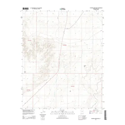
2014 Map of Standing Horse Mesa
USGS Topo · Published 2014About this map
Standing Horse Mesa dominates the high desert landscape of Navajo County, rising as a prominent landform above the surrounding Rincon Basin. This modern topographic study reveals a terrain deeply etched by seasonal drainage systems, most notably Fern Feather Wash which winds across the central and southern portions of the quadrangle. To the south, the edge of Ives Mesa becomes visible, further defining the local topography. The infrastructure of the area is characterized by the presence of Az-87 and several Bureau of Indian Affairs routes, including Bia-60 and Bia-603, providing transit across this arid portion of the Colorado Plateau. The map is a precise record of the land's contours and seasonal watercourses like Humpy Wash, reflecting the sparse but structured network of roads that service this remote high-country region.
Find a feature on this map
13 named features on this map. Tap any name to fly to it.
Don’t see what you’re looking for? This feature index may not catch every label — zoom into the map to look around manually.
Map Details
Editions of this 2014 Standing Horse Mesa Map
This is the sole edition of this map. No revisions or reprints were ever made.
Other maps of this area

1883 · Tusayan
USGS Topo · 1:250,000

1886 · Tusayan
USGS Topo · 1:250,000

1947 · Flagstaff
USGS Topo · 1:250,000

1954 · Winslow
USGS Topo · 1:62,500

1954 · Winslow 4 SE
USGS Topo · 1:24,000

1954 · Winslow 4 NE
USGS Topo · 1:24,000

1954 · Flagstaff
USGS Topo · 1:250,000

1955 · Mal Pais Springs 3 SW
USGS Topo · 1:24,000

1958 · Flagstaff
USGS Topo · 1:250,000

1960 · Flagstaff
USGS Topo · 1:250,000