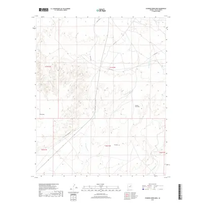
2018 Map of Standing Horse Mesa
USGS Topo · Published 2018About this map
Standing Horse Mesa dominates this high-desert landscape in Navajo County, showcasing a terrain defined by extensive plateau formations and drainage networks. The map details the intricate topography of Ives Mesa and the wide drainage of Rincon Basin, providing a clear view of the arid geography within the Fort Defiance Agency. Human presence is marked by the remote Rincon Ranch and a network of Bureau of Indian Affairs routes, including Indian Rte 60 and Indian Rte 603. Along the southwestern portion of the sheet, Painted Desert Rim Dr tracks the edge of the colorful desert landscape. Seasonal watercourses like Fern Feather Wash and Humpy Wash underscore the hydrologic patterns of the region, where water flow is transient but central to the local environment and ranching operations.
Find a feature on this map
15 named features on this map. Tap any name to fly to it.
Don’t see what you’re looking for? This feature index may not catch every label — zoom into the map to look around manually.
Map Details
Editions of this 2018 Standing Horse Mesa Map
This is the sole edition of this map. No revisions or reprints were ever made.
Other maps of this area

1883 · Tusayan
USGS Topo · 1:250,000

1886 · Tusayan
USGS Topo · 1:250,000

1947 · Flagstaff
USGS Topo · 1:250,000

1954 · Winslow
USGS Topo · 1:62,500

1954 · Winslow 4 SE
USGS Topo · 1:24,000

1954 · Winslow 4 NE
USGS Topo · 1:24,000

1954 · Flagstaff
USGS Topo · 1:250,000

1955 · Mal Pais Springs 3 SW
USGS Topo · 1:24,000

1958 · Flagstaff
USGS Topo · 1:250,000

1960 · Flagstaff
USGS Topo · 1:250,000