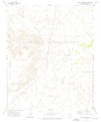
1972 Map of Standing Horse Mesa
USGS Topo · Published 1975About this map
The Borderland Trading Post stands as a focal point of activity in this high desert landscape within the Navajo Indian Reservation. The terrain is defined by the massive elevated profiles of Ives Mesa and Standing Horse Mesa, which overlook the expansive Rincon Basin. This 1972 field-checked survey reveals a land navigated primarily by a network of unimproved routes and a Jeep Trail, illustrating the remote nature of the region during the early 1970s.
Find a feature on this map
15 named features on this map. Tap any name to fly to it.
Don’t see what you’re looking for? This feature index may not catch every label — zoom into the map to look around manually.
Map Details
Editions of this 1972 Standing Horse Mesa Map
This is the sole edition of this map. No revisions or reprints were ever made.
Other maps of this area

1883 · Tusayan
USGS Topo · 1:250,000

1886 · Tusayan
USGS Topo · 1:250,000

1947 · Flagstaff
USGS Topo · 1:250,000

1954 · Winslow
USGS Topo · 1:62,500

1954 · Winslow 4 SE
USGS Topo · 1:24,000

1954 · Winslow 4 NE
USGS Topo · 1:24,000

1954 · Flagstaff
USGS Topo · 1:250,000

1955 · Mal Pais Springs 3 SW
USGS Topo · 1:24,000

1958 · Flagstaff
USGS Topo · 1:250,000

1960 · Flagstaff
USGS Topo · 1:250,000