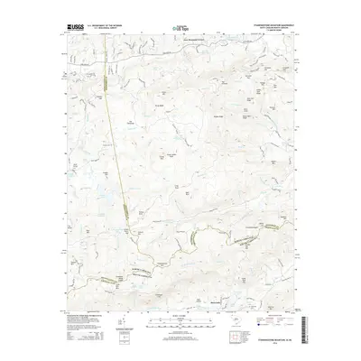
2014 Map of Standingstone Mountain
USGS Topo · Published 2014About this map
Standingstone Mtn anchors this mountainous boundary zone where the Tennessee Valley Divide snakes across the border of Henderson and Transylvania counties in North Carolina and Greenville County in South Carolina. The landscape is defined by its dramatic relief and significant water features, including the notable Hooker Falls and Triple Falls along the Little River. In the northern reaches, the Crab Cr valley supports the settlement of Jeter Mountain Terrace, while the southern slopes descend toward River Falls and the headwaters of the Middle Saluda River. For researchers of local heritage, the map identifies specific landmarks like St Francis Chapel and family-named sites such as Thomas Cem and Vardry McBee Rock, providing a clear look at how human presence has long negotiated the gaps and ridges of this high-elevation terrain.
Find a feature on this map
119 named features on this map. Tap any name to fly to it.
Don’t see what you’re looking for? This feature index may not catch every label — zoom into the map to look around manually.
Map Details
Editions of this 2014 Standingstone Mountain Map
This is the sole edition of this map. No revisions or reprints were ever made.
Other maps of this area

1905 · Pisgah
USGS Topo · 1:125,000

1906 · Pisgah
USGS Topo · 1:125,000

1907 · Saluda
USGS Topo · 1:125,000

1935 · Brevard
USGS Topo · 1:24,000

1935 · Standingstone Mtn.
USGS Topo · 1:24,000

1935 · Horse Shoe
USGS Topo · 1:24,000

1935 · Hendersonville
USGS Topo · 1:24,000

1935 · Table Rock
USGS Topo · 1:24,000

1935 · Zirconia
USGS Topo · 1:24,000

1935 · Pisgah Forest
USGS Topo · 1:24,000
Featured Places
- Jeter Mountain Terrace, NC
- Greenville County, SC
- Henderson County, NC
- Transylvania County, NC
- United States