2002 Map of Stanfield
USGS Topo · Published 2003About this map
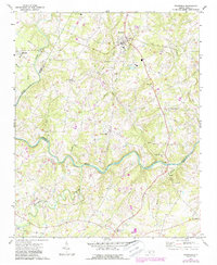
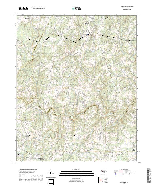
The Rocky River carves a winding path through the Piedmont, serving as a natural boundary between Stanly, Cabarrus, and Union Counties. By the early 2000s, this landscape maintained its rural character, anchored by the crossroads of Midland and Stanfield. The map reveals a dense network of country churches that have historically defined these local communities, including Philadelphia Ch, Loves Chapel, and Morgans Memorial Ch. Local industry and infrastructure are represented by a Sandpit near Midland, a regional Substation, and a significant cross-county Pipeline. Evidence of community heritage is visible in the placement of the Kinza Memorial and numerous small family cemeteries. The terrain is deeply dissected by tributaries like Muddy Creek and Grassy Creek, illustrating the complex drainage patterns that shaped early settlement and road placement in this part of North Carolina.
Find a feature on this map
30 named features on this map. Tap any name to fly to it.
Don’t see what you’re looking for? This feature index may not catch every label — zoom into the map to look around manually.
Map Details
Editions of this 2002 Stanfield Map
This is the sole edition of this map. No revisions or reprints were ever made.
Historical Maps of Fairview Through Time
7 maps found