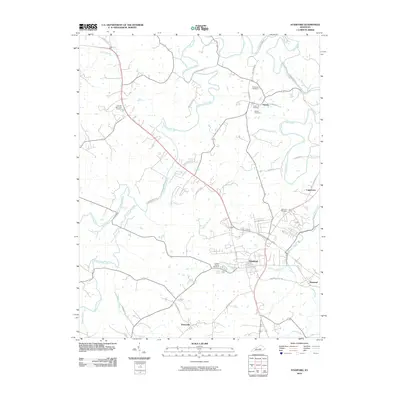
2010 Map of Stanford
USGS Topo · Published 2010About this map
Stanford and its neighboring communities of Rowland and Boneyville anchor this 2010 topographic record of central Kentucky. The landscape is defined by the historic path of the Wilderness Trl and Lincoln Trl, which slice through a terrain deeply etched by the Dix River and numerous tributaries like Hanging Fork Creek and Logan Creek. Genealogists will find several notable burial grounds, including the large Buffalo Spring Cemetery near Buffalo Spring and smaller family-named sites such as Sutton Cemetery and Blackerby Cemetery near Hubble. The map details a transition from the denser street grid of Stanford out to outlying clusters like Logantown. Significant road infrastructure, such as the US Hwy 150 Byp and Rowland Cut-Off Rd, illustrates how modern transportation has overlaid the ancient corridors of the region.
Find a feature on this map
43 named features on this map. Tap any name to fly to it.
Don’t see what you’re looking for? This feature index may not catch every label — zoom into the map to look around manually.
Map Details
Editions of this 2010 Stanford Map
This is the sole edition of this map. No revisions or reprints were ever made.
Other maps of this area

1905 · Harrodsburg
USGS Topo · 1:125,000

1950 · Bryantsville
USGS Topo · 1:24,000

1952 · Halls Gap
USGS Topo · 1:24,000

1952 · Crab Orchard
USGS Topo · 1:24,000

1952 · Buckeye
USGS Topo · 1:24,000

1952 · Hustonville
USGS Topo · 1:24,000

1952 · Danville
USGS Topo · 1:24,000

1952 · Lancaster
USGS Topo · 1:24,000

1952 · Bryantsville
USGS Topo · 1:24,000

1952 · Stanford
USGS Topo · 1:24,000