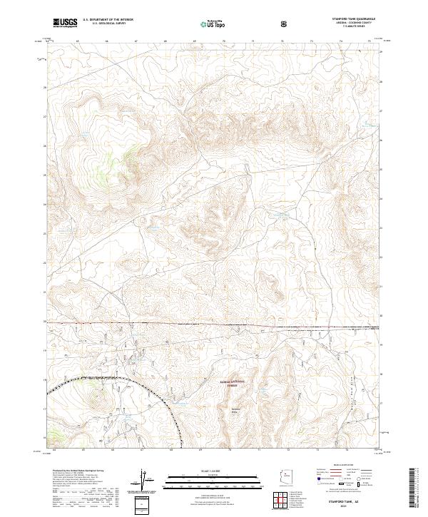
2021 Map of Stanford Tank
USGS Topo · Published 2021About this map
The Kaibab National Forest dominates this high-plateau landscape in northern Arizona, where water management is the defining human footprint. Numerous earthen reservoirs and natural outlets such as Stanford Tank, Reneke Tank, and Apache Spring reveal the essential infrastructure required for ranching and forest management in this arid environment. The terrain is marked by significant topographical shifts near Paradise Ridge and the Martin Dam Draw, which provide natural drainage across the quadrangle. Early transportation routes like Old "2" Rd. and Old "6" Rd snake through the forest, connecting remote catchment areas. This 2021 survey provides a clear look at the contemporary state of the land's hydrology and forest boundaries, illustrating the continued importance of features like White Horse Tank and Con Clair Spring in sustaining the region's activities.
Find a feature on this map
22 named features on this map. Tap any name to fly to it.
Don’t see what you’re looking for? This feature index may not catch every label — zoom into the map to look around manually.
Map Details
Editions of this 2021 Stanford Tank Map
This is the sole edition of this map. No revisions or reprints were ever made.
Other maps of this area

1886 · Chino
USGS Topo · 1:250,000

1891 · Chino
USGS Topo · 1:250,000

1922 · Williams
USGS Topo · 1:125,000

1948 · Williams
USGS Topo · 1:250,000

1954 · Williams
USGS Topo · 1:250,000

1956 · Williams
USGS Topo · 1:250,000

1960 · Williams
USGS Topo · 1:250,000

1961 · Williams
USGS Topo · 1:250,000
1962 · Hearst Mtn.
USGS Topo · 1:62,500
1973 · Eagle Nest Mtn
USGS Topo · 1:24,000