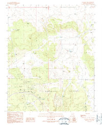
1989 Map of Stanford Tank
USGS Topo · Published 1990About this map
The high desert plateau of Kaibab National Forest dominates this landscape, defined by its extensive network of ranching infrastructure and mineral extraction sites during the late 1980s. Water management is the primary human footprint here, as evidenced by a series of catchment basins including Stanford Tank, Pouquette Tank, and Reneke Tank, which supported livestock at the Aja Ranch. Natural water sources like Apache Spring and Con Clair Spring are also prominent features in this arid Coconino County terrain.
Find a feature on this map
34 named features on this map. Tap any name to fly to it.
Don’t see what you’re looking for? This feature index may not catch every label — zoom into the map to look around manually.
Map Details
Editions of this 1989 Stanford Tank Map
This is the sole edition of this map. No revisions or reprints were ever made.
Other maps of this area

1886 · Chino
USGS Topo · 1:250,000

1891 · Chino
USGS Topo · 1:250,000

1922 · Williams
USGS Topo · 1:125,000

1948 · Williams
USGS Topo · 1:250,000

1954 · Williams
USGS Topo · 1:250,000

1956 · Williams
USGS Topo · 1:250,000

1960 · Williams
USGS Topo · 1:250,000

1961 · Williams
USGS Topo · 1:250,000
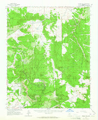
1962 · Hearst Mtn.
USGS Topo · 1:62,500
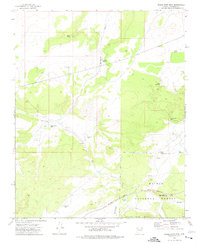
1973 · Eagle Nest Mtn
USGS Topo · 1:24,000