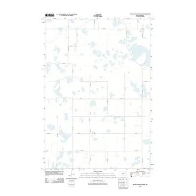
2012 Map of Stangland Slough
USGS Topo · Published 2012About this map
Fron Cem sits near the center of this Marshall County landscape, serving as a primary point of interest for genealogists tracing local families. The terrain is defined by the prairie pothole region's characteristic hydrology, dominated by the sprawling Stangland Slough and Opitz Lake in the northeastern corner. The section-line road grid, including Rose Hill Rd and Co Hwy 5, reflects the enduring legacy of the Public Land Survey System, which organized the rural settlement of South Dakota. While few structures are named, the presence of family-named routes like Al Dentaler Rd suggests the long-standing agricultural heritage of the area. This 2012 survey provides a clear look at the intersection of modern county infrastructure, such as Co Rd 19, and the natural wetlands that have shaped the region's land use for generations.
Find a feature on this map
22 named features on this map. Tap any name to fly to it.
Don’t see what you’re looking for? This feature index may not catch every label — zoom into the map to look around manually.
Map Details
Editions of this 2012 Stangland Slough Map
This is the sole edition of this map. No revisions or reprints were ever made.
Other maps of this area

1953 · Milbank
USGS Topo · 1:250,000

1958 · Milbank
USGS Topo · 1:250,000

1958 · Britton 4 NW
USGS Topo · 1:24,000

1958 · Britton 4 SW
USGS Topo · 1:24,000

1970 · Eden
USGS Topo · 1:24,000

1970 · Britton 4 NE
USGS Topo · 1:24,000

1970 · Lake City
USGS Topo · 1:24,000

1970 · Britton 4 SE
USGS Topo · 1:24,000

1970 · Roslyn
USGS Topo · 1:24,000

1973 · Lynn Lake
USGS Topo · 1:24,000