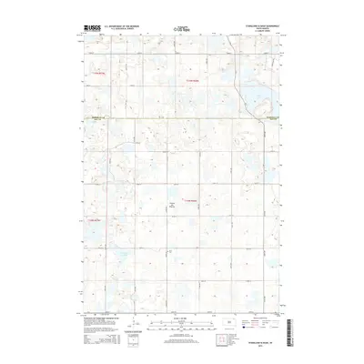
2015 Map of Stangland Slough
USGS Topo · Published 2015About this map
Coteau des Prairies defines the rolling elevation of this landscape along the border of Marshall County and Day County. This glaciated upland in northeastern South Dakota is dotted with numerous small basins and potholes, a characteristic of the Prairie Pothole Region. The mapping focuses on a section of rural farmland organized by a precise grid of township roads, including 122nd St and 432nd Ave. Notable water features include the northern reach of Opitz Lake and the eponymous Stangland Slough in the southwest. Historical and genealogical interest is found at Fron Cem, located centrally within the township grid. The landscape is primarily defined by its hydrologic patterns and the section-line roads that facilitate the region's agricultural transport, such as Aldentaler Rd and CR-5.
Find a feature on this map
25 named features on this map. Tap any name to fly to it.
Don’t see what you’re looking for? This feature index may not catch every label — zoom into the map to look around manually.
Map Details
Editions of this 2015 Stangland Slough Map
This is the sole edition of this map. No revisions or reprints were ever made.
Other maps of this area

1953 · Milbank
USGS Topo · 1:250,000

1958 · Milbank
USGS Topo · 1:250,000

1958 · Britton 4 NW
USGS Topo · 1:24,000

1958 · Britton 4 SW
USGS Topo · 1:24,000

1970 · Eden
USGS Topo · 1:24,000

1970 · Britton 4 NE
USGS Topo · 1:24,000

1970 · Lake City
USGS Topo · 1:24,000

1970 · Britton 4 SE
USGS Topo · 1:24,000

1970 · Roslyn
USGS Topo · 1:24,000

1973 · Lynn Lake
USGS Topo · 1:24,000