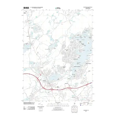
2011 Map of Stanhope
USGS Topo · Published 2011About this map
Lake Hopatcong dominates the eastern half of this landscape, its intricate shoreline defined by numerous points and islands such as Halsey Island and Bertrand Island. This 2011 survey captures the dense residential clusters of Hopatcong and Mount Arlington as they wrap around the water, contrasting with the more industrial and transit-focused corridor to the south. In the lower reaches of the quadrangle, Stanhope and Netcong sit near the shores of Lake Musconetcong, where the Musconetcong River passes through a network of dams and reservoirs.
Find a feature on this map
312 named features on this map. Tap any name to fly to it.
Don’t see what you’re looking for? This feature index may not catch every label — zoom into the map to look around manually.
Map Details
Editions of this 2011 Stanhope Map
This is the sole edition of this map. No revisions or reprints were ever made.
Other maps of this area

1888 · Franklin
USGS Topo · 1:62,500

1888 · Hackettstown
USGS Topo · 1:62,500

1888 · Lake Hopatcong
USGS Topo · 1:62,500

1891 · Wallpack
USGS Topo · 1:62,500

1893 · Wallpack
USGS Topo · 1:62,500

1894 · Hackettstown
USGS Topo · 1:62,500

1894 · Lake Hopatcong
USGS Topo · 1:62,500

1894 · Franklin
USGS Topo · 1:62,500

1897 · Franklin
USGS Topo · 1:62,500

1898 · Lake Hopatcong
USGS Topo · 1:62,500