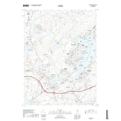
2019 Map of Stanhope
USGS Topo · Published 2019About this map
Stanhope and Netcong anchor the southern reaches of this landscape, where the Musconetcong River flows through Lake Musconetcong. The map detail traces the heavily indented shoreline of southern Lake Hopatcong, revealing numerous coves and points such as King Cove, Point Pleasant, and the residential clusters of Hopatcong and Mount Arlington. This 2019 survey documents a dense network of suburban development and recreational infrastructure, including the Sussex Branch Trail and the Highlands Trail. North of the busy corridor, the terrain rises into the Sparta Mountains and Allamuchy Mtn, where smaller water bodies like Wolf Lake and Stag Pond sit among more forested areas. For genealogists, the Stanhope Union Cem serves as a key landmark in a region defined by its transition from industrial river towns to lakeside communities.
Find a feature on this map
282 named features on this map. Tap any name to fly to it.
Don’t see what you’re looking for? This feature index may not catch every label — zoom into the map to look around manually.
Map Details
Editions of this 2019 Stanhope Map
This is the sole edition of this map. No revisions or reprints were ever made.
Other maps of this area

1888 · Franklin
USGS Topo · 1:62,500

1888 · Hackettstown
USGS Topo · 1:62,500

1888 · Lake Hopatcong
USGS Topo · 1:62,500

1891 · Wallpack
USGS Topo · 1:62,500

1893 · Wallpack
USGS Topo · 1:62,500

1894 · Hackettstown
USGS Topo · 1:62,500

1894 · Lake Hopatcong
USGS Topo · 1:62,500

1894 · Franklin
USGS Topo · 1:62,500

1897 · Franklin
USGS Topo · 1:62,500

1898 · Lake Hopatcong
USGS Topo · 1:62,500