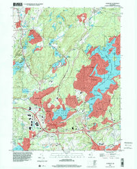
1995 Map of Stanhope
USGS Topo · Published 2000About this map
Lake Hopatcong and its intricate shoreline dominate the eastern half of this terrain, where numerous points and coves like Byram Bay and Henderson Cove reveal a landscape deeply shaped by recreation and water management. To the south, the industrial and residential corridors of Netcong, Stanhope, and Port Morris cluster near the Morris County RR and the Musconetcong State Park boundary. This late-century survey illustrates the dense suburbanization around the historic iron-district towns, contrasting the developed Hopatcong Hills with the expansive protected lands of Allamuchy State Park in the west. Local genealogy and history are anchored by institutions such as Stanhope Union Cem, St Joseph Sch, and the Hudson Maxim Sch, while the presence of a Landing Field near Netcong highlights the infrastructure of the era.
Find a feature on this map
119 named features on this map. Tap any name to fly to it.
Don’t see what you’re looking for? This feature index may not catch every label — zoom into the map to look around manually.
Map Details
Editions of this 1995 Stanhope Map
This is the sole edition of this map. No revisions or reprints were ever made.
Other maps of this area

1888 · Franklin
USGS Topo · 1:62,500

1888 · Hackettstown
USGS Topo · 1:62,500

1888 · Lake Hopatcong
USGS Topo · 1:62,500

1891 · Wallpack
USGS Topo · 1:62,500

1893 · Wallpack
USGS Topo · 1:62,500

1894 · Hackettstown
USGS Topo · 1:62,500

1894 · Lake Hopatcong
USGS Topo · 1:62,500

1894 · Franklin
USGS Topo · 1:62,500

1897 · Franklin
USGS Topo · 1:62,500

1898 · Lake Hopatcong
USGS Topo · 1:62,500