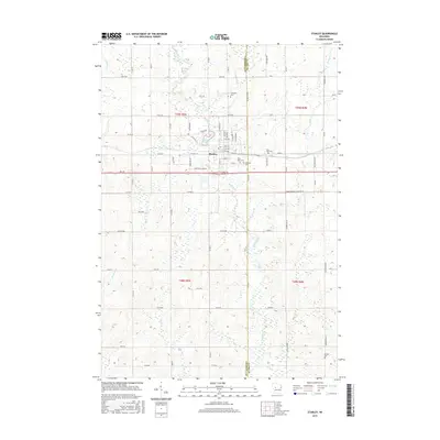
2015 Map of Stanley
USGS Topo · Published 2015About this map
Stanley serves as the primary hub of this 2015 survey, situated where the Chippewa Co and Clark Co line defines the landscape. The city’s residential grid is established north of the highway, anchored by Chapman Lake and the winding course of the Wolf River. For family historians, the area is notably dense with burial sites, including Evergreen Cem to the north, East Side Cem and Oakland Cem near the town center, and the more distant Worden Cem to the southeast. The surrounding rural townships, including t29n r5w and t28n r4w, are defined by a complex network of tributaries such as Roger Cr, Muskrat Cr, and Little Otter Cr. This modern topographic study records the persistent intersection of agricultural land use and municipal growth at the county boundary.
Find a feature on this map
76 named features on this map. Tap any name to fly to it.
Don’t see what you’re looking for? This feature index may not catch every label — zoom into the map to look around manually.
Map Details
Editions of this 2015 Stanley Map
This is the sole edition of this map. No revisions or reprints were ever made.
Other maps of this area

1951 · Cornell
USGS Topo · 1:62,500

1951 · Gilman
USGS Topo · 1:62,500

1952 · Cadott
USGS Topo · 1:62,500

1952 · Stanley
USGS Topo · 1:62,500

1953 · Eau Claire
USGS Topo · 1:250,000

1953 · Rice Lake
USGS Topo · 1:250,000

1958 · Eau Claire
USGS Topo · 1:250,000

1959 · Rice Lake
USGS Topo · 1:250,000

1964 · Eau Claire
USGS Topo · 1:250,000
1973 · Colburn
USGS Topo · 1:24,000